• There has been a recent cluster of spammers accessing BARFer accounts and posting spam. To safeguard your account, please consider changing your password. It would be even better to take the additional step of enabling 2 Factor Authentication (2FA) on your BARF account. Read more here.

Photos of your bike on location

And the blade pays by the hour to operate the motorcycle pays differently .
A talented operator on a blade can get a lot of work done.​
 
A couple more from yesterday. I must say this thread has been making my solo rides a bit more enjoyable.

Back door to Foothill Park on Page Mill.
1754925153791.png

The Bridge on Pescadero Road.
1754925218082.png

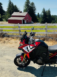
The big red barn on 84. Both in focus. (pats self on the back).
1754925342888.png

1754925403036.png
 
Who has the time ??
:teeth


When I size my "photos" thru e-mail, I use the word pix, E-mail don't care
I know my string of sent e-mails to myself, with pix, in the title, are easy to find.

"Pictures of your bike on location"
Doesn't exist either.
 
Last edited:
Weekday mornings on Hwy 1 are sometimes wet, sometimes windy, but never crowded. I typically stop around here at Pigeon Point as there's usually an ambient weather difference when going between San Mateo and Santa Cruz counties. There's a nice swell hitting a lot of California that looks small but fun.

IMG_0567.jpgIMG_0568.jpg
 
That looks shiny sweet! :thumbup

Look forward to more locations.
 
You've waited a long time for it, and it looks absolutely sweet. Have fun!
 
Last edited by a moderator:
Pilot Peak - New Route

I have been to Pilot Peak via three different routes, but I have tracked down a fourth one and that was the purpose of today's ride. Anytime I can ride a road that I haven't been on before is something special. It's getting harder to do.

Looking east from north Boise Ridge Rd.
NE8C3ys.jpg


The road I haven't been on before between Alder Creek Rd and Grimes Pass Rd.
7ehwwsc.jpg


The road between Grimes Pass Rd and Pilot Peak.
atVbq6w.jpg


Made it through to a road I'm familiar with.
nwCBbo6.jpg


On Pilot Peak looking east toward the Sawtooth Mountains. Elevation 8100 ft.
7GEyKyf.jpg


The lookout on Sunset Mountain. Right across Highway 21 and about the same distance from the road as Pilot Peak. There was always a closed gate lower down in the past that prevented me from riding/driving all the way up to the lookout. Elevation 7860 ft.
Mz1nLhS.jpg


My original plan was to ride back up to Pilot peak again and take the dirt road down all the way to Pioneerville, but I was so tired, the best I could do was Highway 21 all the way back. I'm tired of that road on every outing lately. I'm heading a different direction next time.
 
Pilot Peak - New Route
I'm heading a different direction next time.
Been out Owyhee Reservoir yet? Lots of nothing out that way too.
Went up there with a nephew a few years ago. Seen some pics from there on ADV.
 
Back
Top