johnkol
Active member
Thanks for the info. You are both correct, found this information at a Plumas County page: both roads are currently closed, which means that the only open road without any restrictions is Hwy 32.
Last report I heard from Bucks Lake Rd was on 4/2 and it was washed out in at least one spot. Seems like 2 months would be enough time to repair it, but I dunno for sure.

Yeah, rode 162 out of Oroville last weekend. Still closed at Mt. House. We rode to the closure and turned around. Why? Cause it's a great road! Wentworth Springs as far as I know is still closed around Uncle Tom's Cabin.
I rode Wentworth 2 weeks ago. It is open from Georgetown to Ice House Rd. I didn't take it in the direction of Loon lake. 11 pines is closed, however, just about 1/2 mile in from Wentworth. Ice House Rd is open. Mosquito Ridge Rd is open from Forrest Hill to French Meadows but not sure how much farther you can go after that. Lots of trees down out there.
")
89, monitor pass is open. I'm planning on a 88, 89,395 to Bridgeport for lunch ride this Saturday.
While you're up there, if you have a spare hour, take a detour over to Calaveras Dome. It's quite interesting. You can either take the road that goes by Bear River Reservoir or take Ellis Road a little bit further west. It's worth seeing at least once. Head towards Salt Springs Reservoir to get there.My brother lives in east Sacramento. Thinking about spending the night at his place and then doing a day trip up 88, novelty ride around the lake, and then back via 88 or 50, depending on the time.
While you're up there, if you have a spare hour, take a detour over to Calaveras Dome. It's quite interesting. You can either take the road that goes by Bear River Reservoir or take Ellis Road a little bit further west. It's worth seeing at least once. Head towards Salt Springs Reservoir to get there.
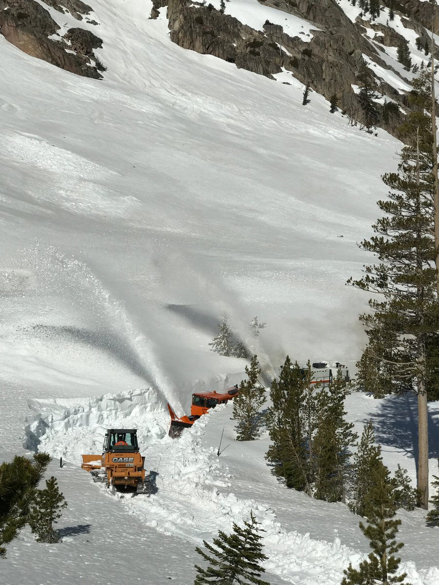
Caltrans said:A lot of people wonder how we find the road through all the snow. On SR-108, the Sonora Pass, Caltrans Supervisor Chris Baker informs me that his crew locates the road by electrifying a line that is embedded in the center of the highway. He then uses a locator to detect it and as you see in the photo, puts environmentally friendly marks for the dozer to follow. The dozer then pushes snow down to the blower. And then the blower operators can follow center line from there and widen out the highway. Simple, huh?

Speaking of passes...I'm going to do a ride there before the end of the month. Coming from the east and going back over towards SF, what pass would be better between Carson (88) and Ebbets (4)? I rode Sonora a while back and that was fun, but wanted to ride a different pass this time.
Whichever route is open, and it won't be Highway 120 over Tioga Pass.What route would you guys recommend to get to Lee Vinning the June 8-12? 120 is the direct route but I haven't see any of the other passes. Riding out that Thurs, camping out off 395, doing day trips from there then riding back Sunday. Not sure if I'll take my F4i or my 690SM.
Whichever route is open, and it won't be Highway 120 over Tioga Pass.
Can somebody (I nominate you) dig through all of the replies and come up with a simple list of which passes are still closed?
Thank you for posting that summary.Closed: 4, 108, 120, Sherman Pass Rd (thru Sequoia NF)
Open: 178
Open, but boring: 50, 80
Open with traffic controls: 88
Fell into a canyon, but open: 70